Document

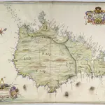
A colored plan of the island of "Sarnia et vulgo Guernsey;" drawn in 1680, by Thomas Phillips, on a scale of 2 3/16 inches to a mile.
This map of Guernsey, drawn at a scale of 1: 28 964, accompanies "A briefe state of Guernsey, by the Right Honoble. Christopher, Lord Hatton, present governor of the said island." Another copy of Lord Hatton's work, but without a map, is in Additional Ms. 6253.
The British LibraryThomas Phillips
1680

